Plex.Earth Tools for AutoCAD 2010-2017 3.6

Plex.Earth provides the tools to utilize aerial/satellite imagery & terrain data
4.2 
Rating
Your vote:
Latest version:
3.6.5990 See all
Developer:
Screenshots
1 / 2
Shareware
Used by 1 person
Download

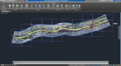
Plex.Earth provides the tools to utilize aerial/satellite imagery and terrain data, by connecting to Google Earth/Maps, Bing Maps, OpenStreetMap, USGS or any other WMS service. With this program, you can easily specify the project's area and create mosaic to fill with high-resolution images.

Requires AutoCAD 2010-2017 and Civil 3D, Map 3D, Architecture, Mechanical.

Comments

4.2
Rating
5 votes
5 stars
3
4 stars
1
3 stars
0
2 stars
1
1 stars
0
User

Your vote:

Related software

Autodesk Autodesk AutoCAD Map 3D SP2
Autodesk Autodesk AutoCAD
rating

AutoCAD Map 3D is a model-based GIS and mapping software.

UNBRAKO AutoCAD Product Library
Free
rating

UNBRAKO AutoCAD reduces the design revision time considerably.

AutoCAD Plant 3D 2010 Object Enablers
AutoCAD Plant 3D 2010 Object
Free
rating

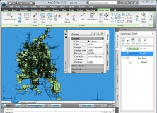
It can can be used to access, display, and manipulate object data.

AutoCAD 2012 Model Documentation Object Enabler
AutoCAD 2012 Model Documentation
Free
rating

The object enabler permits only displaying of drawing views.

ObjectARX Wizards for AutoCAD 2012
ObjectARX Wizards for AutoCAD
Free
rating

It is used for exporting the projects to Visual Studio 2008 and 2010.