Plex.Earth Tools for AutoCAD 2010-2017
Download

Plex.Earth Tools for AutoCAD 2010-2017

Plex.Earth provides the tools to utilize aerial/satellite imagery & terrain data
4.2 
Rating
Your vote:
Latest version:
3.6.5990 See all
Developer:
Screenshots
1 / 2
Shareware
Used by 1 person
Download

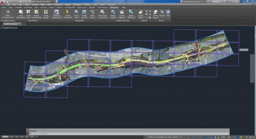
Plex.Earth provides the tools to utilize aerial/satellite imagery and terrain data, by connecting to Google Earth/Maps, Bing Maps, OpenStreetMap, USGS or any other WMS service. With this program, you can easily specify the project's area and create mosaic to fill with high-resolution images.

Requires AutoCAD 2010-2017 and Civil 3D, Map 3D, Architecture, Mechanical.

Comments

4.2
Rating
5 votes
5 stars
3
4 stars
1
3 stars
0
2 stars
1
1 stars
0
User

Your vote: